Weather
Overview
Weather forecasts up to 10 days ahead for any of your saved locations, powered by Apple WeatherKit.
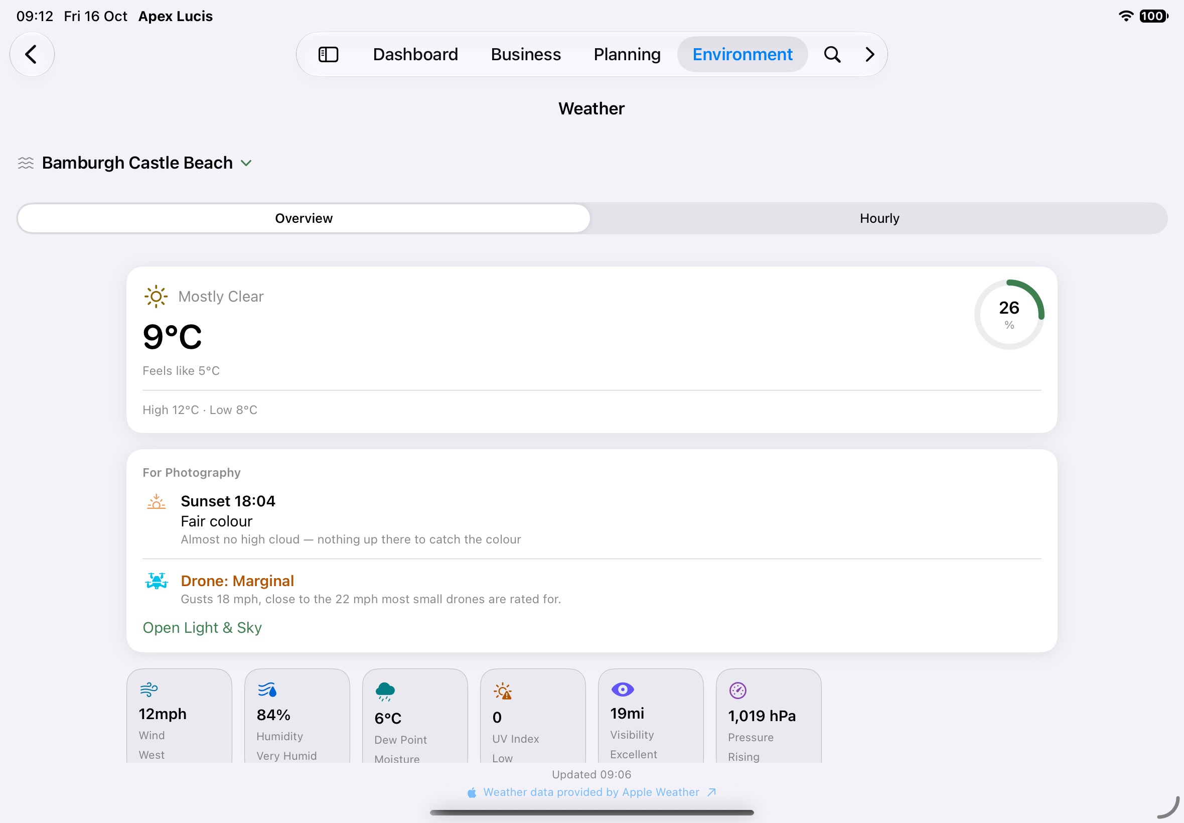
Accessing Weather
Environment tab → Weather
Tap the location name at the top to choose another saved location. Times are in the location’s own time zone, and the screen says so — “Times in JST” — when that differs from yours.
The Two Sections
Overview Tab
- Current conditions: the temperature, what it feels like, today’s high and low, and cloud cover
- For Photography — the colour forecast for the next sunrise or sunset that’s still to come, with the reason; whether it’s calm enough to fly a drone, judged on the gusts as well as the wind; and Open Light & Sky for the same place
- Wind (the arrow points the way the wind is blowing), humidity, dew point, UV index, visibility and pressure. A high UV index or poor visibility is flagged in orange
- 10-day forecast: the conditions, chance of rain and the day’s temperature range on one scale, so you can compare days at a glance
Hourly Tab
- Temperature and Chance of Rain for the next 24 hours, each with a line saying what it means — “Dry until 16:00, then 70% chance of rain”, “Warmest 15° at 14:00, coldest 6° at 05:00”
- Hour by Hour — temperature, chance of rain, cloud cover and wind for each hour
Updated 09:14 at the foot says how fresh the forecast is. Pull down to refresh it; on a Mac use the Refresh button or View → Refresh Forecast (⌘R).
If the forecast can’t be loaded, the screen says why — no connection, Apple Weather taking too long — with Try Again.
Reading Conditions for Photography
| Metric | What Photographers Care About |
|---|---|
| Cloud cover | Low cloud → soft diffused light; 0% → harsh shadows at midday |
| Wind speed | High wind → blur in long exposures, unstable tripods |
| Precipitation | Rain before sunrise can create dramatic skies; heavy rain risks gear |
| UV index | Indicator of haze — high UV often means clearer skies |