Location Scout
Overview
Your location library. Every place you photograph, scout, or want to remember goes here. Locations can be linked to bookings, environmental data, and moon alignment calculations.
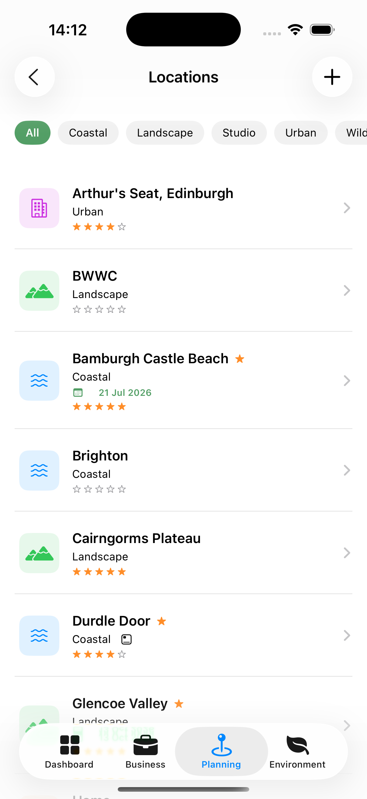
Location Types
| Type | Examples |
|---|---|
| Coastal | Beach, cliff, harbour |
| Indoor | Church, warehouse, venue |
| Landscape | Moorland, fields, mountains |
| Landmark | Historic Building, a natural wonder |
| Studio | Commercial studio space |
| Urban | City streets, rooftops |
| Wildlife | Nature reserves, hides |
Accessing Locations
Planning tab → Locations
The location list can be filtered by type using the chips at the top:
- All
- Coastal
- Landmark
- Studio
- Urban
- Wildlife
- Favourites (locations you’ve pinned)
On iPad and Mac, a map panel shows all your locations as pins.
Adding a Location
- Tap +
- Enter:
- Name (required)
- Type — Select from the location type list
- Rating — 1 to 5 stars
- Notes — Anything useful to remember
- Tap Save
Using the Map you can search for towns, cities, places of interest. Selecting one from the list that appears beneath the map will populate the Name, Address and update the Coordinates.
If the location is near where you are, you can drag the map to the desired location. You can expand the map to make this process easier.
The location’s coordinates are automatically captured from the address for use in all environmental calculations.
Location Detail Sheet
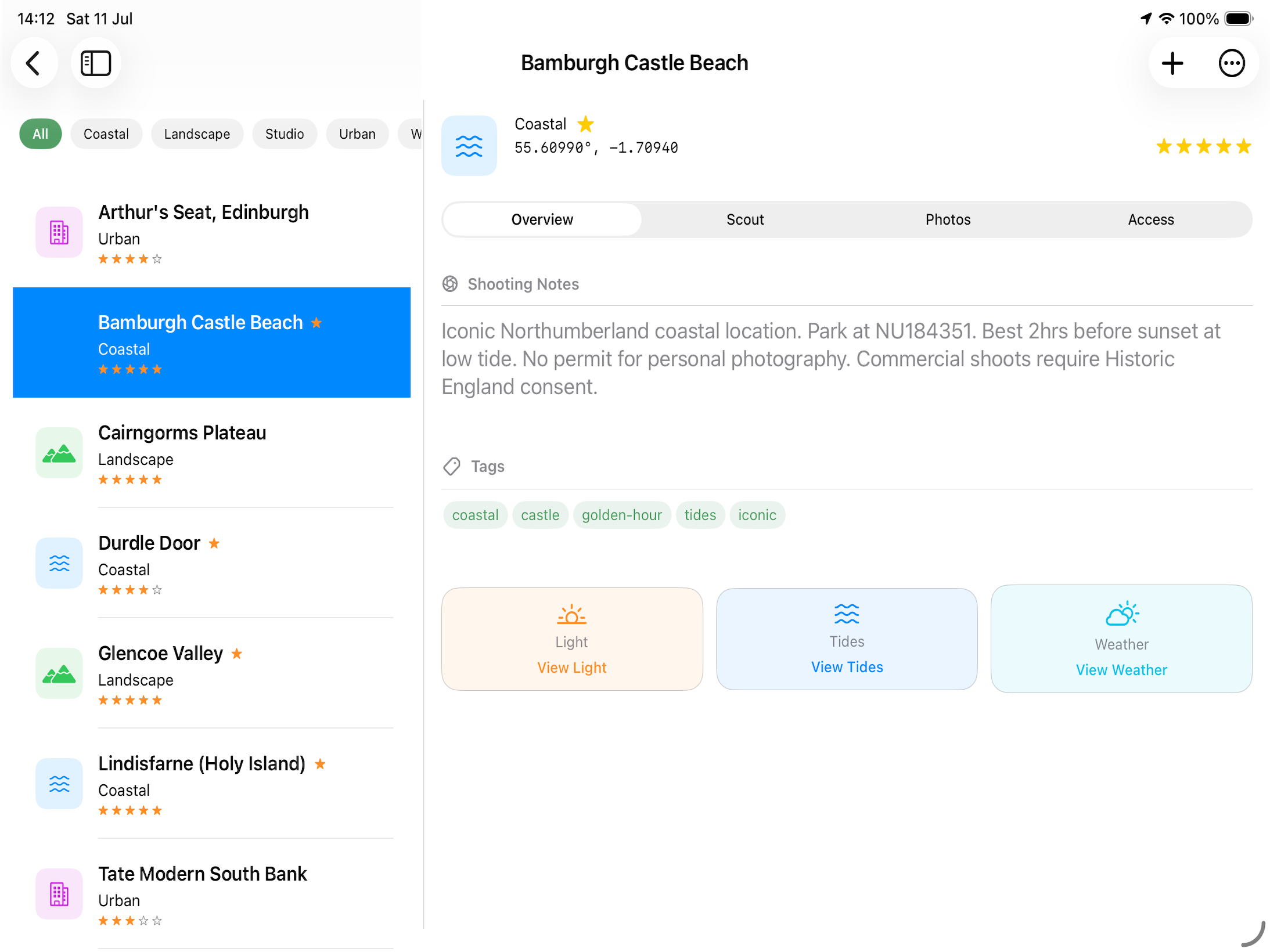
Tapping a location opens a sheet with four tabs:
Overview Tab
- Name, type, star rating
- Address with map link
- Your personal notes
- Quick links to Weather, Light and Tides (if relevant)
Scout Tab
- Coordinates and Elevation
- Shows live data for today if available:
- Sunrise / sunset
- Golden hour windows
- Moon phase
- Moon alignment Planner
Photos Tab
- Photos of the location you’ve added
- Tap any photo to open the full-screen gallery viewer
- Pinch to zoom in the gallery
- Tap Add Reference Photo to add from your camera roll or take a new photo
Access Tab
- Parking notes
- Public access vs. private land
- Access restrictions (e.g., dawn to dusk only)
- Permits
Editing a Location
From the location detail sheet, tap Edit to modify any field.
You can drag the map to move the pin, or type coordinates directly — each keeps the other in step. Nothing is saved until you tap Save, so you can pan around to get your bearings without moving the location, and Cancel puts the pin back where it started.
Moving a location moves its timezone too. When you save a location whose pin has moved any real distance, Apex Lucis re-resolves its timezone. This matters more than it sounds: sunrise, sunset and golden hour are all reported in the location’s own time, so a location dragged from London to Auckland would otherwise report its light at the wrong time of day.
Tide Cut-Off
For a Coastal location where the water can cut you off — a sand flat, a causeway, a beach below a cliff — set a Safe Height in the location’s edit sheet.
It is the water height, in metres above chart datum, at which the place stops being safe for you. Every booking at that location then shows when the tide will reach it and how long that leaves you. See Tide Cut-Off on a booking.
The field is empty until you fill it in, and it only appears for a Coastal location. Switch the type away from Coastal and the height is cleared.
Turn the alert on per booking in its Alerts, where it appears once the location has a height. It arrives an hour before the water reaches it.
Warning: Apex Lucis cannot know what height is safe where you shoot. Set it from local knowledge or official advice, and leave yourself a margin.
Disclaimer: A tide prediction does not account for weather, surge or the shape of the ground. Official local tide tables, harbour authorities and coastguard advice come first. See Settings → Disclaimer.
Pinning a Location as a Favourite
Tap the star icon (☆) in the location detail to pin it. Favourites appear in the Dashboard’s quick-access strip.